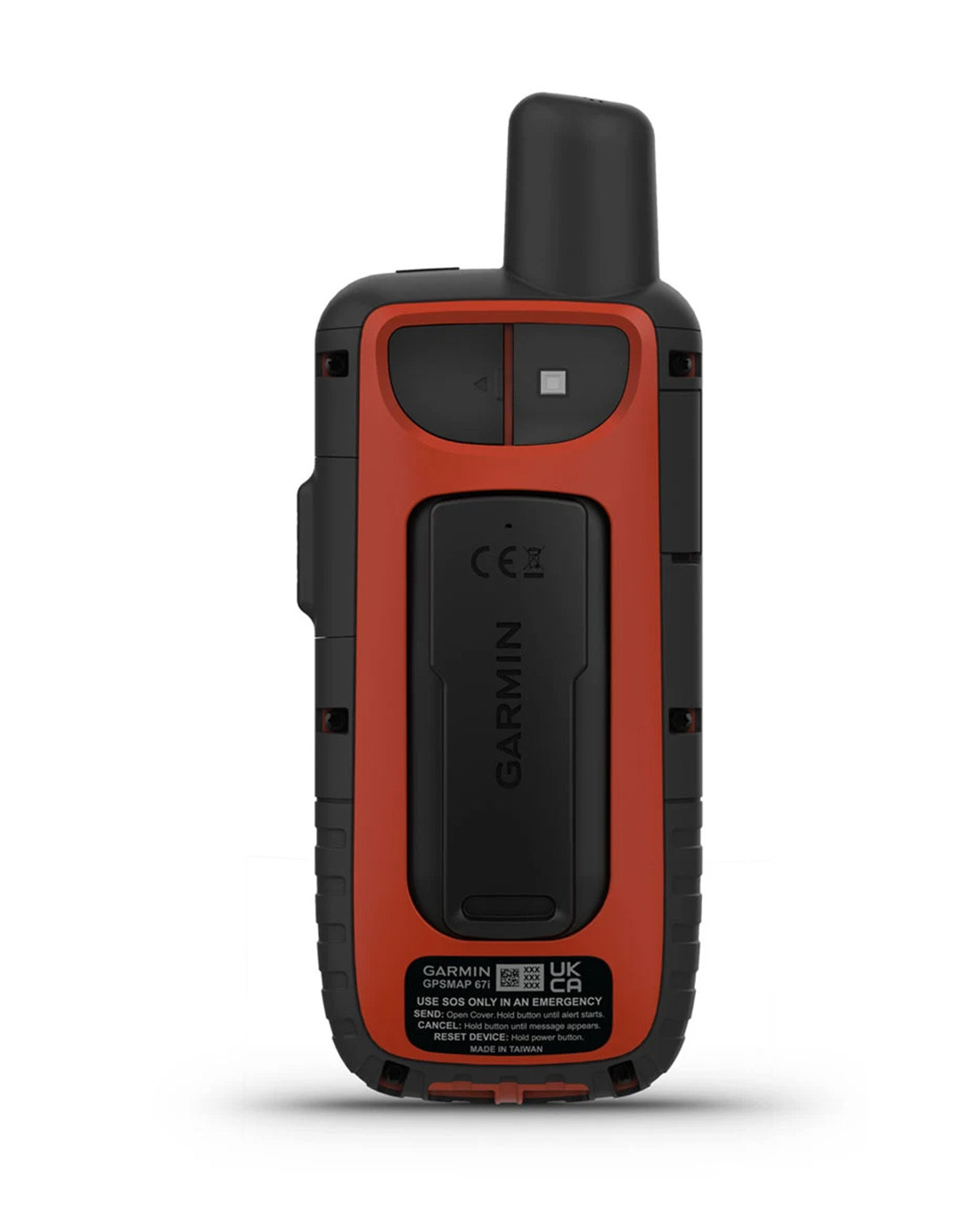
Color: Black / Red
Type / Function: 16 GB memory, expandable to 32 GB, GPS-Device
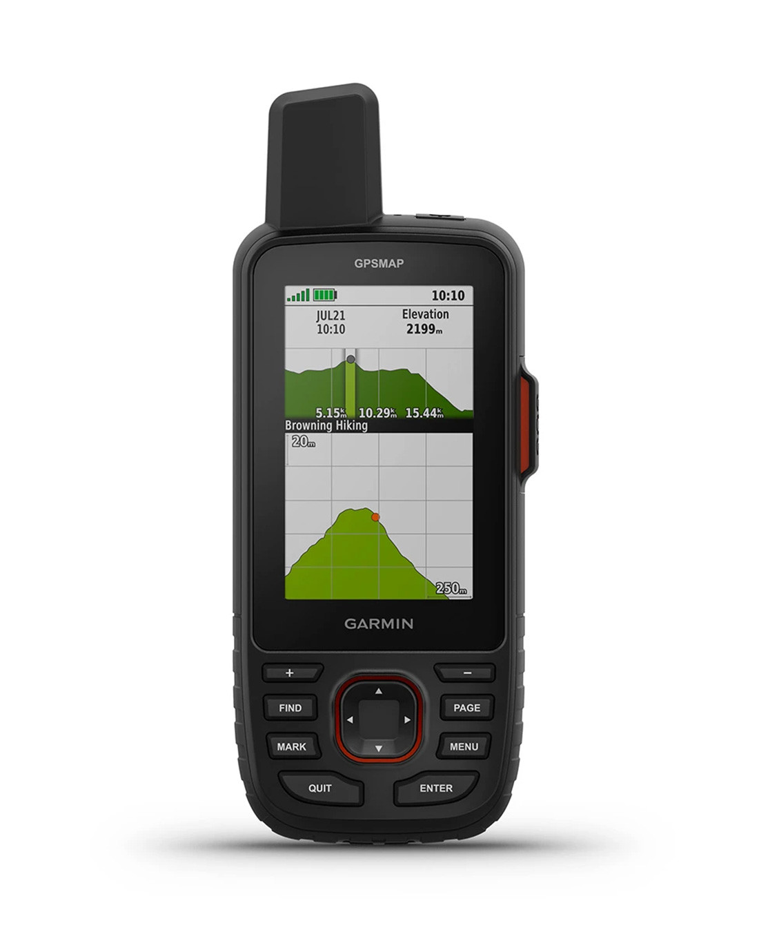
Display: 3 inch TFT-Color display with 240 x 400 Pixel
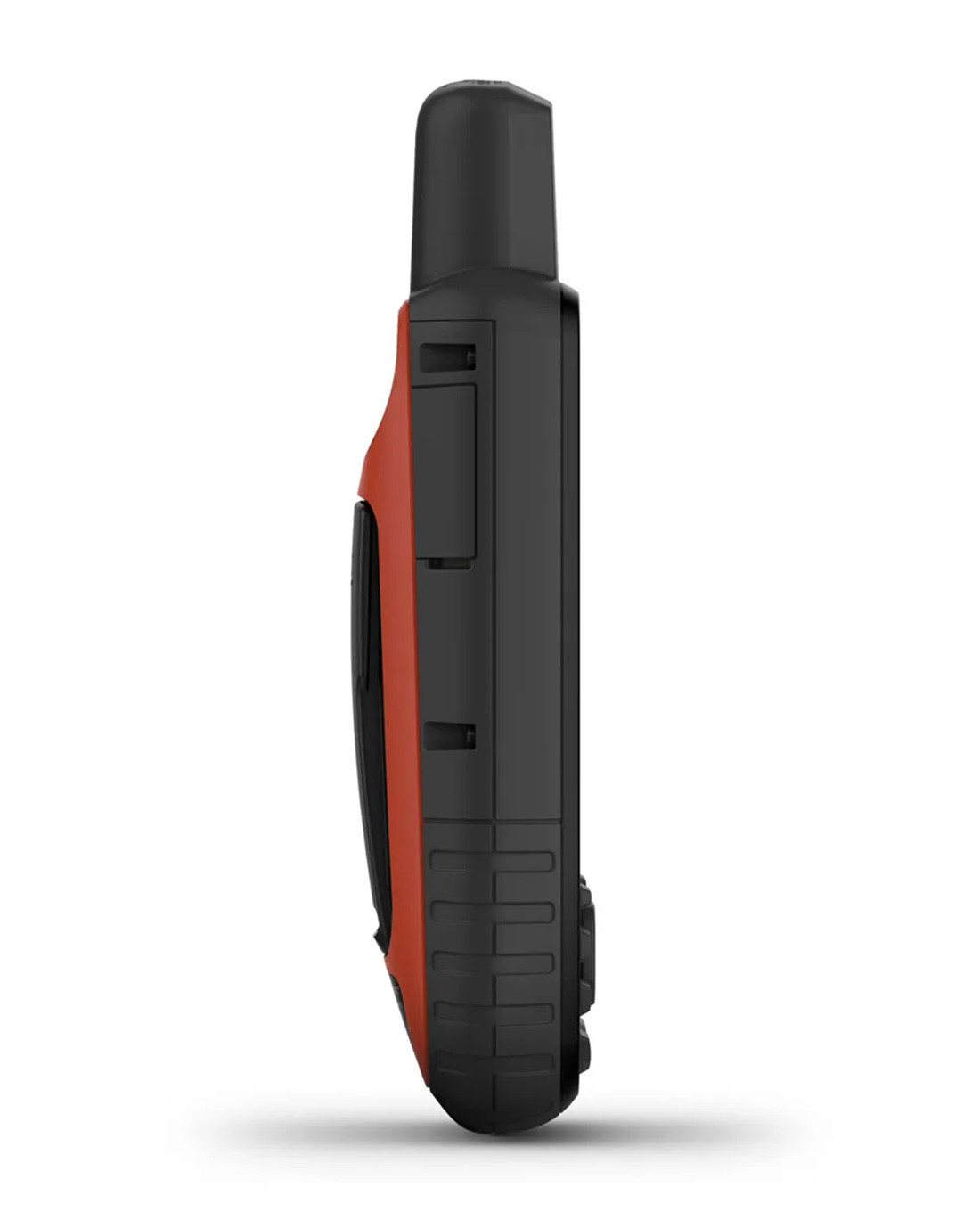
Dimensions: 6.2 x 16.3 x 3.5 cm
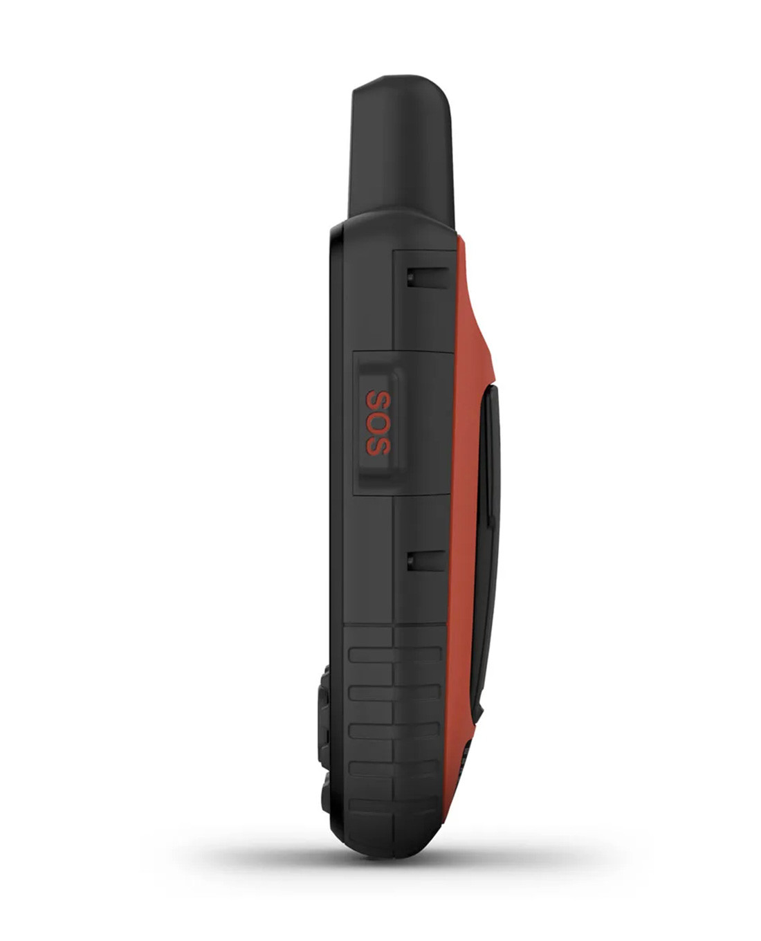
Special Features: Compatible with NVG, LED Torch, Rechargeable, SOS mode, Waterproof
Brand: Garmin
Model: GPSMAP 67i
Battery type: Lithium-ion battery
Material: Plastic Housing certified to US military standard MIL-STD-810
Waterproof to: Waterproof according to IPX7
Weight: 0,48 kg


Garmin GPSMAP 67i
Item no.: 010-02812-01
EAN: 0753759308643
no shipping available to United States of America, US!
€649.90
incl. VAT, plus Shipping costs
Shipping and return
-
-
Description
GPS handheld device with the latest satellite technology
The latest GPS handheld device from Garmin works with the most advanced inReach satellite technology and accompanies you on exciting adventures in the great outdoors. With its robust design, the new GPSMAP 67i is ideal for exploring the forest, mountains or water. Use functions such as two-way communication, interactive SOS emergency calls and position sharing via inReach to stay connected at all times. The integrated maps help you to stay reliably on the right track. Experience the world in a new way and always stay safely connected.
Structure
Housing
The shock-resistant housing of the GPSMAP 67i is made of solid plastic, certified to US military standard MIL-STD-810 and tested for water resistance to IPX7. With its handy dimensions and light weight of 230 grams, it fits easily into any pocket to save space.
Display
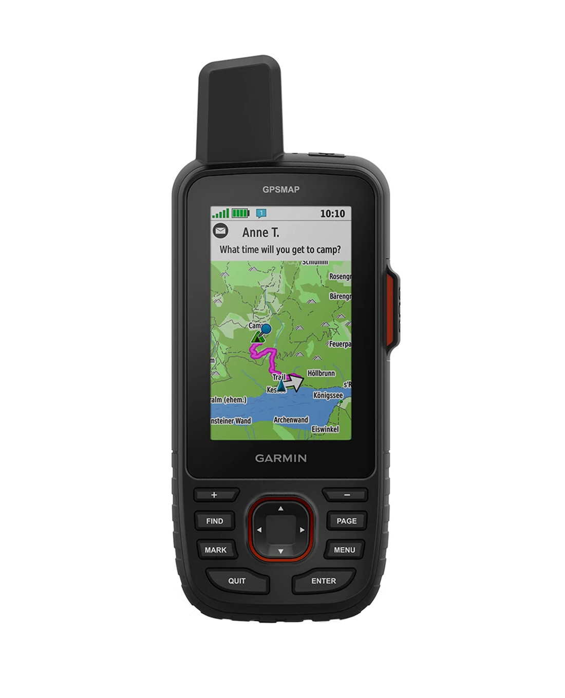
The TFT-Color display with a 3-inch diagonal has a resolution of 240 x 400 pixels, is protected from damage by chemically hardened glass and can even be used with NVG. These displays are characterised by excellent readability in bright ambient.
Technology
Rechargeable battery
With a runtime of up to 165 hours in tracking mode and up to 425 hours in expedition mode, the integrated lithium-ion battery delivers solid performance for days out in the wild. It is charged via a USB-C interface.
Operating system
The device memory of 16 GB can be easily expanded to 32 GB using a MicroSD card. Connectivity via Bluetooth, ANT+ and Wi-Fi, as well as easy compatibility with iPhones and smartphones, ensures additional expansion with the apps from the Connect IQ system in addition to the already extensive functions. Pre-installed maps, routes and waypoints can be customised and expanded to suit your outdoor activities.
Torch
To keep your equipment as compact and light as possible, the GPSMAP offers practical functions such as an integrated LED torch, which can also be used as an auxiliary signal in an emergency.
Functions
GPS
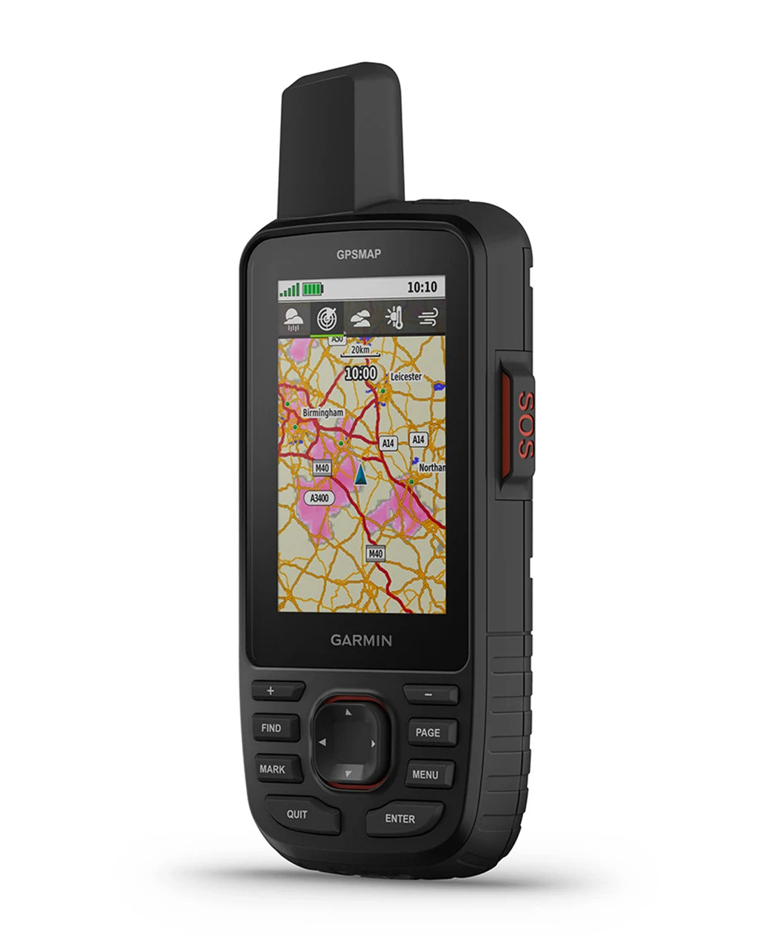
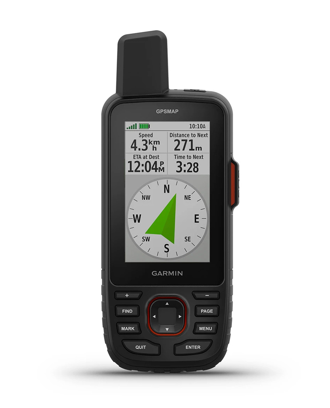
The multi-frequency reception utilises several global navigation satellite systems, including GPS, Galileo and QZSS. This enables even better positioning accuracy. Pre-installed TopoActive Europe maps show exactly where parks, coastlines, rivers, lakes and important geographical points are located. High-resolution and photorealistic satellite images can be downloaded via WLAN to create precise waypoints. Additional ABC sensors, including an altimeter, a barometer to monitor the weather and an electronic 3-axis compass navigate you precisely through the trails you have created.
Connections and communication
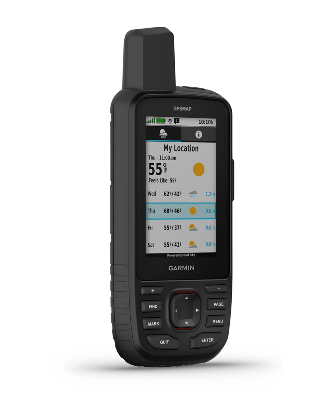
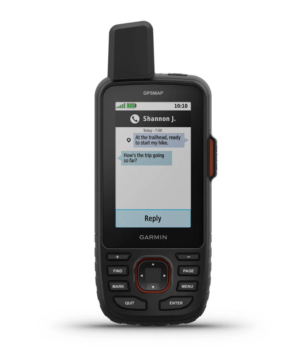
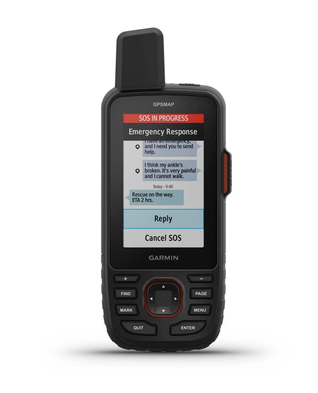
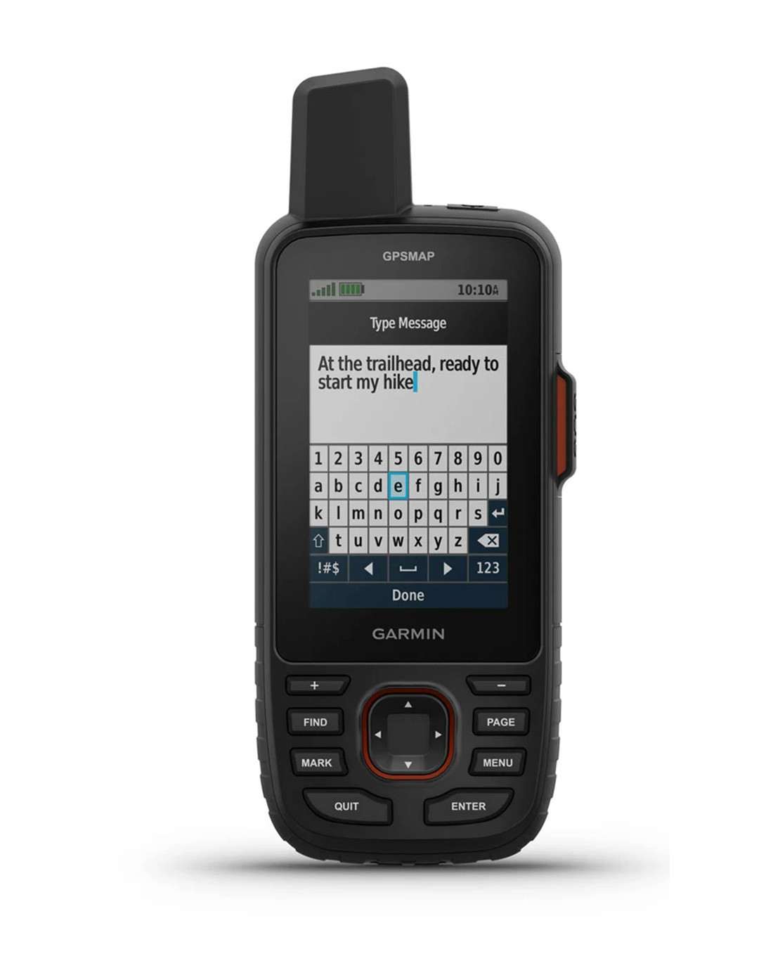
Conveniently choose between tracking or expedition mode. In tracking mode, your route is recorded and your position is saved at regular intervals. Expedition mode uses inReach satellite technology and ensures two-way communication with other inReach devices. Thanks to the global Iridium satellite network, you can be reached worldwide and are independent of any mobile phone network. Your messages, SOS emergency calls and positions are transmitted worldwide. Send messages or social media posts. Share your position with friends and family, or make an interactive emergency call. In addition, inReach provides you with detailed weather forecasts for your current position, your route and the way ahead.
Extensions
Map material
With an Outdoor Maps+ subscription, for example, you receive additional information on land and its owners, government flight plans or hunting ground boundaries.
Garmin Messanger app
In conjunction with your compatible smartphone, you can send individual or group messages quickly and easily.
Explore app
Plan your next trip by downloading additional maps, waypoints or routes. Use them to create your new customised routes or view activities you have already completed while on the move.
Geocaching
Receive cache updates from Geocaching Live, including descriptions, logs and tips. In conjunction with the Garmin Explore app, achievements are saved and uploaded to your geocaching profile.
For every explorer, the new GPSMAP67i offers more than other handheld GPS devices with its extensive pre-installed functions. The numerous additional expansion options via Wi-Fi and smartphone make it customisable for every upcoming exploration tour. A clear "must have" from Garmin.
Scope of delivery- USB cable from type A to type C
- Carabiner clip
Features
- Handheld GPS device with inReach® satellite technology
- Ideal for exploring in the forest, mountains or on the water
- Pre-installed TopoActive Europe maps
- Shock-resistant housing certified to US military standard MIL-STD-810
- Waterproof according to IPX7
- 230 gram weight
- Colour MIP display (Memory-in-Pixel) 3 inch
- Can be used with NVG
- Display cover made of chemically hardened glass
- Powerful lithium-ion battery
- Battery life from 165 to 425 hours depending on usage
- USB-C interface
- Device memory of 16 GB, expandable to 32 GB via MicroSD card
- Connectivity via Bluetooth, ANT+ and Wi-Fi
- Easy compatibility with iPhone and smartphone
- Functions and map material expandable via Garmin Connect IQ system
- Integrated LED torch
- Utilises several global navigation satellite systems, GPS, Galileo and QZSS
- Outdoor sensors such as altimeter, barometer and 3-axis compass
- Expedition mode utilises inReach satellite technology
- Two-way communication with other inReach devices
- Additional detailed weather forecasts
Click here for the Garmin manual!
GARMIN products are not discountable!
-
Attributes
-
Related Products
-

-
-
-

-

-
 Garmin Instinct 3 45 mm, Solar, Tactical Edition Black €449.90 €499.90 ** -10%Last lowest price: €449.90 +0%New
-
-
Product reviews
No product reviews available.
-
Product safety
Manufacturer information:Garmin Deutschland GmbH
Email:
Parkring 35
85748 Garching
Germany (DE)
Phone: +49 89 541999-700
Web: https://www.garmin.com/de-DE/
[email protected]
Responsible person:Garmin Deutschland GmbH
Email:
Parkring 35
85748 Garching
Germany (DE)
Phone: +49 89 541999-700
Web: https://www.garmin.com/de-DE/
[email protected]